Maritime Trade Map: Navigating the Waters of Global Commerce
The maritime trade industry has been an essential cornerstone of global commerce for centuries. Ships sailing across oceans, carrying goods and connecting nations, have played a pivotal role in shaping the world as we know it today. A critical tool in this vast network of seaborne trade is the maritime trade map.
The Importance of Maritime Trade Maps
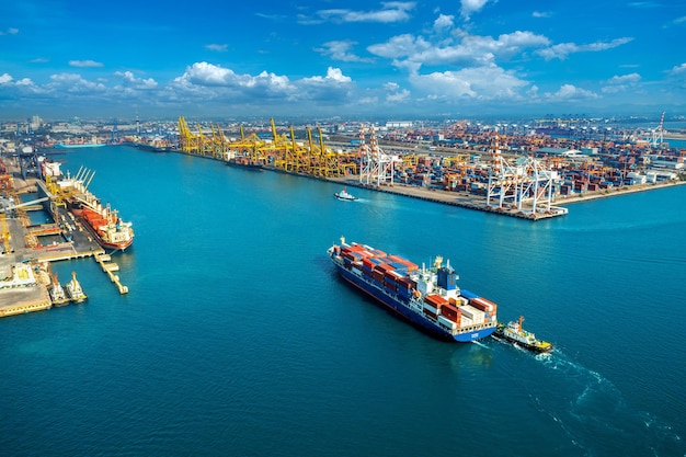
Maritime trade maps provide invaluable information about shipping routes, ports, trade lanes, and other significant aspects of the global maritime trade network. They serve as a navigational aid for ship captains, logistics managers, and analysts, enabling them to plan efficient routes, identify potential risks, and optimize trade operations. These maps facilitate the smooth flow of goods, fostering economic growth and prosperity.
Maritime trade maps offer several key benefits:
- Route Optimization: By analyzing trade maps, shipping companies can determine the most efficient routes for their vessels. Factors such as distance, prevailing winds, and sea currents are taken into account to minimize fuel consumption and reduce transit times, ultimately cutting costs and increasing profitability.
- Identifying Trade Opportunities: Trade maps highlight major shipping routes between regions, allowing businesses to identify potential markets for their goods. Such insights enable companies to target specific regions, assess demand, and develop strategic business plans for expansion into new markets.
- Risk Mitigation: Maritime trade maps help shipping companies assess potential risks and plan contingency measures. Information on piracy-prone areas, hazardous weather conditions, or geopolitical tensions can be crucial in ensuring the safety of crew and cargo, as well as avoiding disruptions in the supply chain.
- Market Analysis: By analyzing maritime trade data integrated into maps, analysts can gain valuable insights into global trade trends. This information helps governments, policymakers, and businesses make data-driven decisions, anticipate market changes, and devise effective trade policies.
Mapping Technologies and Data Sources
The development of modern mapping technologies has revolutionized the accuracy and sophistication of maritime trade maps. Today, a diverse array of data sources and tools are utilized to create comprehensive and up-to-date maps.
One of the primary sources of data for maritime trade maps is Automatic Identification System (AIS), which is mandatory for most commercial vessels. AIS transponders on ships transmit vital information such as position, course, speed, and identity. This data, collected in real-time, provides the basis for mapping vessel movements and identifying trade routes.
“Maritime trade maps offer several key benefits: route optimization, identifying trade opportunities, risk mitigation, and market analysis.”
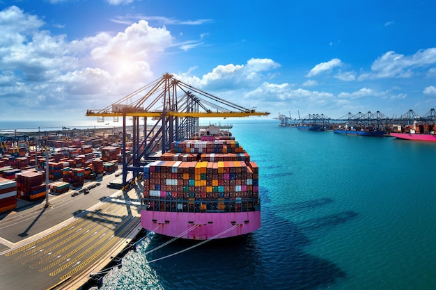
In addition to AIS data, satellite imagery and remote sensing technologies contribute significantly to the accuracy and detail of maritime trade maps. Satellite imagery captures high-resolution images of ports, coastal areas, and shipping traffic, allowing for precise mapping of seaborne activities.
The integration of geographic information systems (GIS) further enhances the functionality of maritime trade maps. GIS enables the overlaying of diverse data sets, such as population density, infrastructure, or natural resources, onto the map. This integration facilitates comprehensive analysis and decision-making, benefiting various stakeholders in the maritime trade industry.
Visualizing Maritime Trade Data
Visual representations of maritime trade data make complex information more accessible and actionable. Maps can display various aspects of the maritime trade network, including:
- Vessel movements: Tracking the real-time positions and paths of ships.
- Port locations: Identifying major ports and their capabilities.
- Shipping routes: Highlighting significant trade lanes and transit hubs.
- Cargo flows: Visualizing the movement of specific goods throughout the world.
For instance, a map can show the busiest shipping routes connecting continents or display the flow of raw materials from resource-rich regions to manufacturing centers. These visualizations help stakeholders make informed decisions, evaluate market potential, and assess infrastructure requirements.
The Future of Maritime Trade Maps
As technology continues to advance, maritime trade maps hold even more promise for the future. Here are a few key trends and developments:
- Real-time data: With the increasing availability of real-time data from AIS and other sources, maritime trade maps can provide up-to-the-minute information on vessel movements, enabling dynamic decision-making.
- Big data analytics: Advanced analytics tools can process vast amounts of maritime trade data, identifying patterns, trends, and anomalies. This approach enables more accurate predictions and proactive risk management.
- Integration with Internet of Things (IoT): Enhanced connectivity and IoT devices on ships and ports allow for seamless data exchange. This integration can provide comprehensive insights into the entire logistics chain, optimizing operations and reducing inefficiencies.
These advancements in mapping technologies and data analysis will revolutionize the way maritime trade is conducted, making operations more efficient, secure, and sustainable.
Conclusion
The maritime trade map is an indispensable tool for navigating the complex waters of global commerce. It provides critical information for optimizing trade routes, identifying opportunities, mitigating risks, and analyzing market trends. With the advancement of mapping technologies and the integration of diverse data sources, maritime trade maps have become more accurate, detailed, and accessible than ever before. As the industry embraces real-time data and advanced analytics, the future of maritime trade maps holds great potential for revolutionizing global trade operations.